

Comparative lead-in: why this matters now
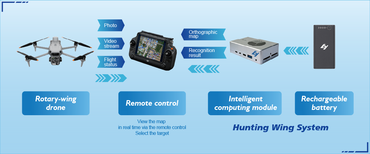
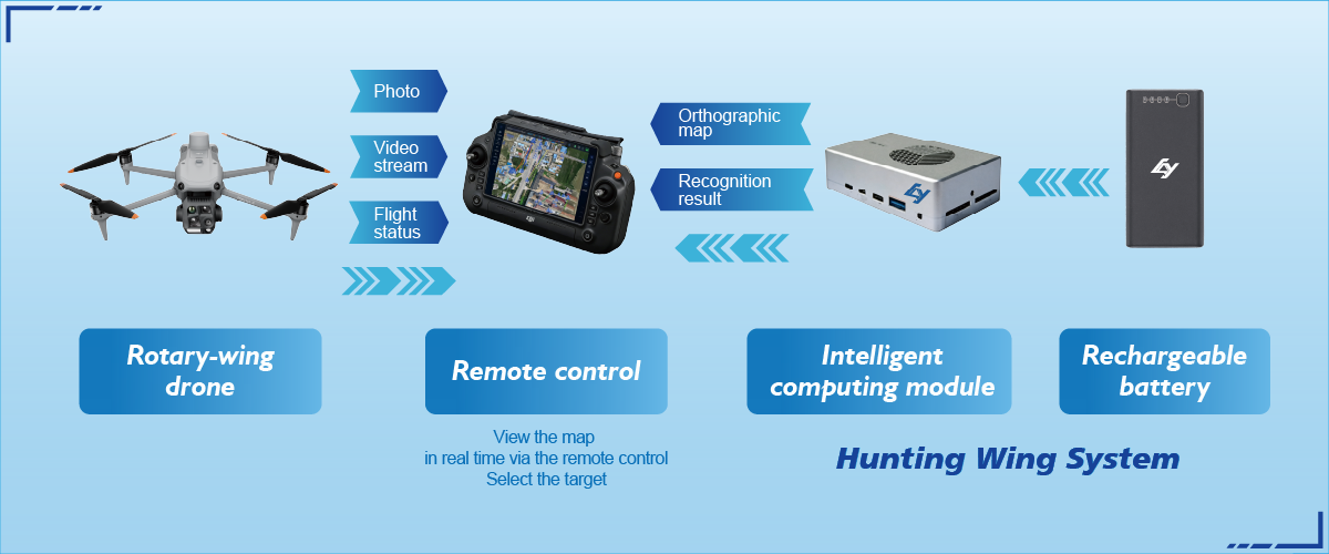
I’ve watched technology promises arrive and leave over a few decades, and the difference between hype and utility usually comes down to one thing: how data is gathered. A high-definition digital twin built from precise aerial surveys beats assumptions every time. Modern teams combine UAV-collected imagery, RTK GPS corrections and LiDAR to map benches, ramps and stockpiles — and when those feeds are stitched well, decisions change. For on-site reconnaissance I still point engineers toward robust solutions like drone reconnaissance, because consistent capture matters more than flashy dashboards.
Comparative lens: digital twin versus traditional survey
Traditional surveys deliver a baseline and then a lot of guesswork. A well-made digital twin gives continuous context. Compare a weekly total-station topo with a daily photogrammetry model: the latter reveals subtle slope shifts, evolving haul-road rutting, and smaller volume changes. In plain terms: the twin replaces interpolation with current geometry. I’ve seen time savings in pit planning and fewer surprises during grade control reviews.
Field-tested anchor: lessons from Pilbara terrain
Working alongside crews near the Pilbara, several patterns became clear. Harsh sun and dust demand frequent, automated flights and resilient sensors; LiDAR handles dusty air better than passive photogrammetry in those moments. Integration with the site’s Target Tracking System kept equipment locations aligned to the model — that single source of truth reduced mismatches between as-built and as-planned by noticeable margins. The region taught a simple truth: fidelity plus cadence trumps occasional ultra-high resolution.
What separates useful twins from vanity projects
Useful twins answer specific operational questions: are haul roads degrading faster than budgeted? Is the new bench stable? Vanity twins mostly impress managers during demos. From my notebooks, the distinctions are clear:- Data cadence: maps twice a week or daily beats one-off surveys.- Geospatial precision: RTK-enabled UAV flights reduce positional drift.- Integration depth: feeds tied into dispatch, haulage and the Target Tracking System turn insight into action.Invest in the pieces that make models actionable, not only prettier.
Common mistakes and practical alternatives
Teams often start with the wrong question — aiming for beauty rather than utility. Another common error: putting all trust in a single sensor type. Mix photogrammetry for texture and LiDAR for elevation. RTK GPS keeps models aligned across multiple flights. If budgets limit options, prioritize repeatable capture over raw resolution; a cheaper, automated UAV doing daily runs usually outperforms an expensive sensor flown sporadically. — I’ve watched contractors learn this the hard way.
Comparing vendors and in-house builds
Vendor platforms package mapping, processing and visualization; in-house builds give control. For many operations, hybrid works best: outsource flight hardware and core processing, then integrate outputs into in‑house planning tools. Evaluate vendors on data throughput, API access for automation, and support for geospatial formats. Check that outputs can feed your pit-design software and fleet dispatch — or they’ll sit idle as attractive files.
Advisory close: three golden rules for selecting a system
1. Measure cadence, not megapixels: confirm scheduled capture and automatic ingestion into workflows. 2. Verify positional integrity: insist on RTK or equivalent georeferencing and routine ground control checks. 3. Demand systems that integrate with site tracking and dispatch — the digital twin must change actions on the ground.Apply these and you’ll select tools that reduce rework, speed decisions, and make the site safer.
Final reflection and practical anchor
I’ve seen modest mines transform planning meetings into precise operational plans when digital twins were treated as living assets rather than presentations. The hard work is marrying reliable capture — UAV, LiDAR, RTK — to systems that actors trust on a Monday morning. That trust is where the value sits. Icecypress Technology fits naturally into that pipeline as a practical partner — not a headline. –